MCKENZIE PROD MCKENZIE N.SHORE/SUPERIOR MAP #103
A detailed topographic map designed for outdoor enthusiasts exploring the Boundary Waters Canoe Area Wilderness (BWCAW). Printed on durable, water-resistant material, this map highlights lakes, portages, campsites, trails, and contours, making it an essential navigation aid for canoeing, fishing, and backcountry trips.
Each McKenzie map includes:
-
1:31,680 scale (2 inches = 1 mile) for accurate detail
-
Clearly marked entry points and portage distances
-
Latitude/longitude grid for GPS users
-
Coverage of surrounding lakes, rivers, and campsites
Like all McKenzie BWCA maps, #103 integrates seamlessly with adjoining maps for extended route planning and backcountry adventures.
Original: $7.49
-65%$7.49
$2.62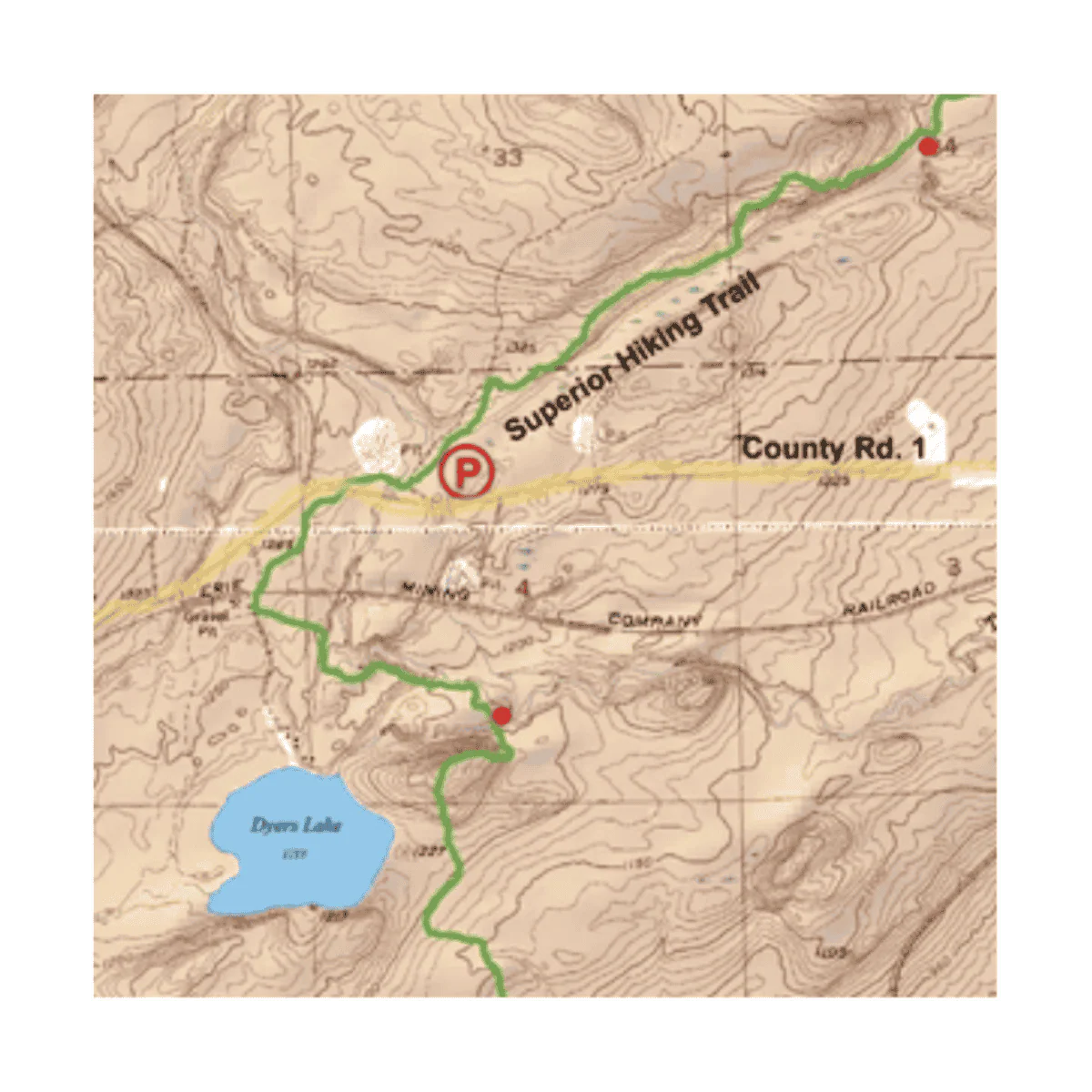
Description
A detailed topographic map designed for outdoor enthusiasts exploring the Boundary Waters Canoe Area Wilderness (BWCAW). Printed on durable, water-resistant material, this map highlights lakes, portages, campsites, trails, and contours, making it an essential navigation aid for canoeing, fishing, and backcountry trips.
Each McKenzie map includes:
-
1:31,680 scale (2 inches = 1 mile) for accurate detail
-
Clearly marked entry points and portage distances
-
Latitude/longitude grid for GPS users
-
Coverage of surrounding lakes, rivers, and campsites
Like all McKenzie BWCA maps, #103 integrates seamlessly with adjoining maps for extended route planning and backcountry adventures.