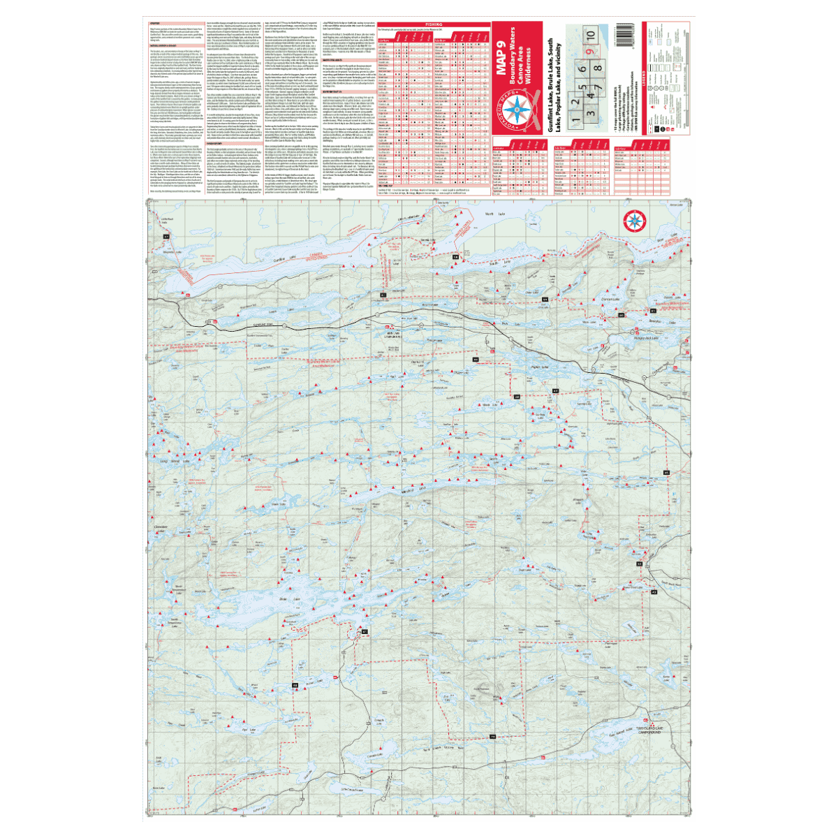
VOYAGEUR BWCA MAP 9 – GUNFLINT TRAIL REGION (PORTRAIT ORIENTATION)
Map 9 spans both sides of the Gunflint Trail and is uniquely formatted in portrait mode to capture more of the BWCA in a single map.
To the north lies the historic Height of Land Portage between North and South Lake where waters divide toward Hudson Bay and Lake Superior.
The southern region includes eight entry points, offering excellent loop routes and one-way trips into scenic, less-traveled areas.
Description
Map 9 spans both sides of the Gunflint Trail and is uniquely formatted in portrait mode to capture more of the BWCA in a single map.
To the north lies the historic Height of Land Portage between North and South Lake where waters divide toward Hudson Bay and Lake Superior.
The southern region includes eight entry points, offering excellent loop routes and one-way trips into scenic, less-traveled areas.