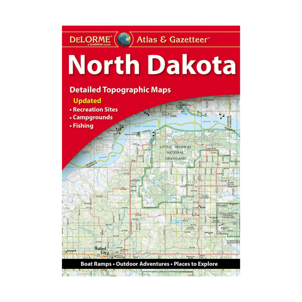
LAKEMAPS DELORME ATLAS/GAZETTEER NORTH DAKOTA
Packed with rich, detailed information, DeLorme’s Atlas & Gazetteer is the ideal resource for exploring North Dakota. Its full-color topographic maps—supported by a thorough index—showcase everything from cities and rural towns to historic landmarks, scenic byways, buttes, ranchlands, trailheads, boat launches, and top fishing locations. Conveniently bound in a book-style format, this Atlas & Gazetteer serves as one of the most comprehensive and reliable guides to North Dakota’s backcountry.
Features:
-
Full-color topographic maps highlighting cities, towns, historic sites, scenic drives, recreation areas, trailheads, boat ramps, and popular fishing spots
-
Extensive index for quick reference
-
Latitude/longitude grid overlays on each map for straightforward GPS navigation
-
Inset maps for major cities and all state lands
Product Details:
-
Dimensions: 15.5" x 11"
-
Copyright: 2025
Description
Packed with rich, detailed information, DeLorme’s Atlas & Gazetteer is the ideal resource for exploring North Dakota. Its full-color topographic maps—supported by a thorough index—showcase everything from cities and rural towns to historic landmarks, scenic byways, buttes, ranchlands, trailheads, boat launches, and top fishing locations. Conveniently bound in a book-style format, this Atlas & Gazetteer serves as one of the most comprehensive and reliable guides to North Dakota’s backcountry.
Features:
-
Full-color topographic maps highlighting cities, towns, historic sites, scenic drives, recreation areas, trailheads, boat ramps, and popular fishing spots
-
Extensive index for quick reference
-
Latitude/longitude grid overlays on each map for straightforward GPS navigation
-
Inset maps for major cities and all state lands
Product Details:
-
Dimensions: 15.5" x 11"
-
Copyright: 2025