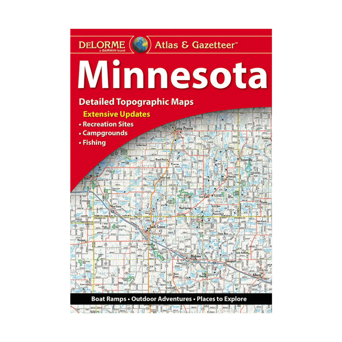
LAKEMAPS DELORME ATLAS/GAZETTEER - MINNESOTA
Filled with exceptional detail, DeLorme’s Atlas & Gazetteer is the ideal guide for discovering the Minnesota outdoors. Its extensively indexed, full-color topographic maps highlight everything from cities and small towns to historic landmarks, scenic routes, trailheads, boat launches, and top fishing areas. With 49 map pages in total, this Atlas & Gazetteer stands as one of the most complete navigational resources for exploring Minnesota’s backcountry.
Features:
-
Vibrant topographic maps covering cities, towns, historic sites, scenic drives, recreation areas, trailheads, boat ramps, and prime fishing locations
-
Comprehensive index for quick lookups
-
Latitude/longitude grid overlays on each map for easy GPS navigation
-
Inset maps for major cities and all state lands
-
Color-highlighted state forest lands, wildlife management areas, and national waterfowl production areas
Product Details:
-
Dimensions: 15.5" x 11"
-
Copyright 2023
Description
Filled with exceptional detail, DeLorme’s Atlas & Gazetteer is the ideal guide for discovering the Minnesota outdoors. Its extensively indexed, full-color topographic maps highlight everything from cities and small towns to historic landmarks, scenic routes, trailheads, boat launches, and top fishing areas. With 49 map pages in total, this Atlas & Gazetteer stands as one of the most complete navigational resources for exploring Minnesota’s backcountry.
Features:
-
Vibrant topographic maps covering cities, towns, historic sites, scenic drives, recreation areas, trailheads, boat ramps, and prime fishing locations
-
Comprehensive index for quick lookups
-
Latitude/longitude grid overlays on each map for easy GPS navigation
-
Inset maps for major cities and all state lands
-
Color-highlighted state forest lands, wildlife management areas, and national waterfowl production areas
Product Details:
-
Dimensions: 15.5" x 11"
-
Copyright 2023