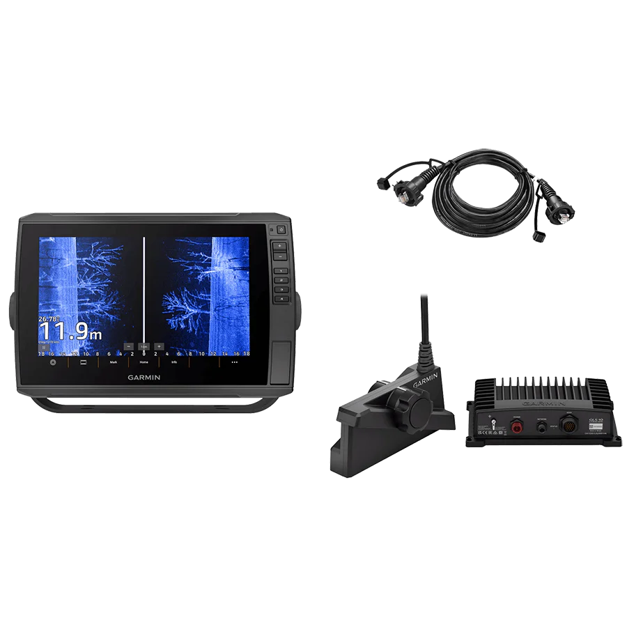
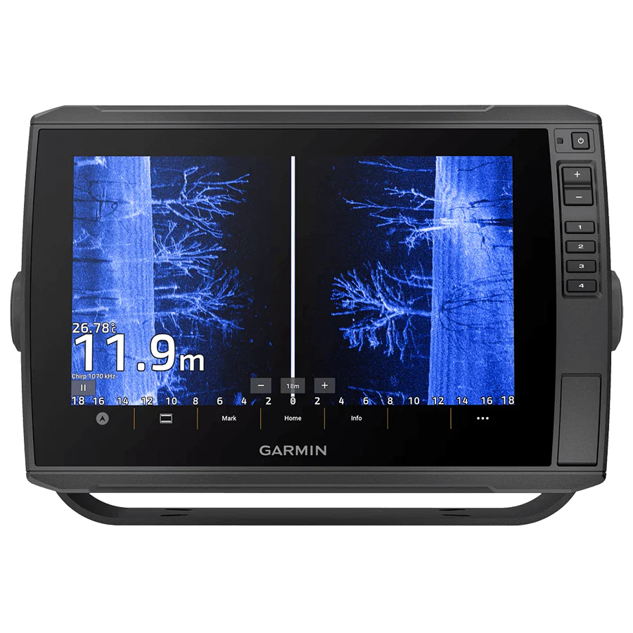
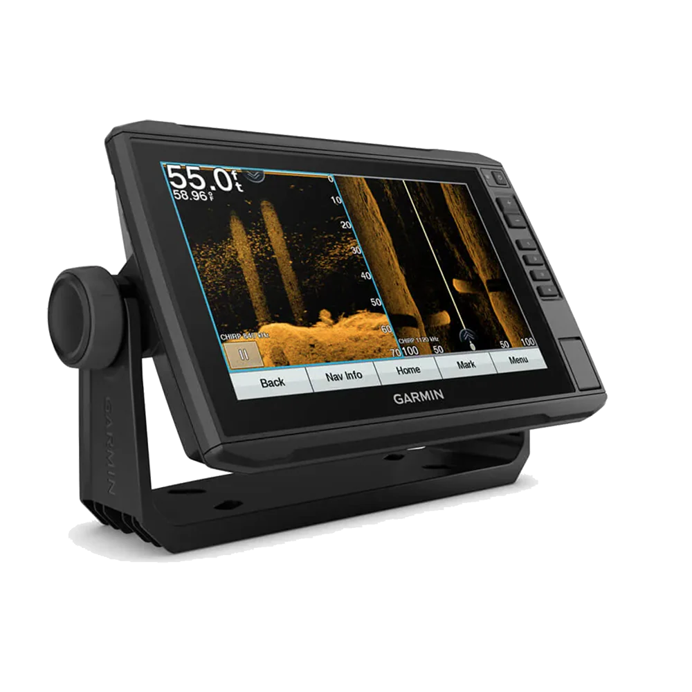
ECHOMAP 2020 UHD 93SV LK - 9"
LESS TIME FINDING. MORE TIME FISHING.
The sunlight-readable 9” touchscreen chart plotter features a quick-release bail mount, and the transducer bundle adds Ultra High-Definition scanning sonar and CHIRP traditional sonar.
- See below and around your boat in incredible detail with the transducer bundle.
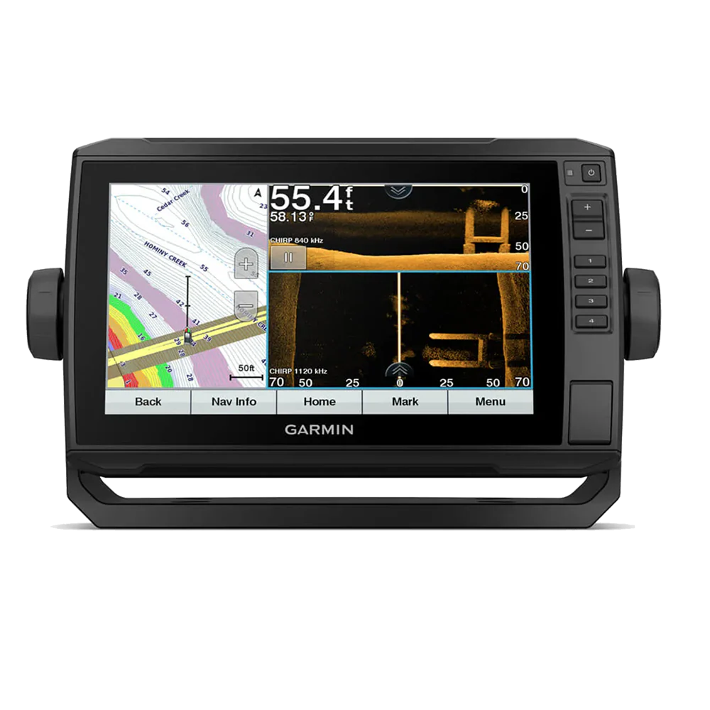
- Navigate any waters with preloaded LakeVü g3 inland maps.
- Share data and maps with select ECHOMAP devices on your network.
- Manage your marine experience from nearly anywhere1.
- Control the most powerful trolling motor available2.
- Create your own maps on the fly and tailor them to fit your needs.
SONAR SUPPORT
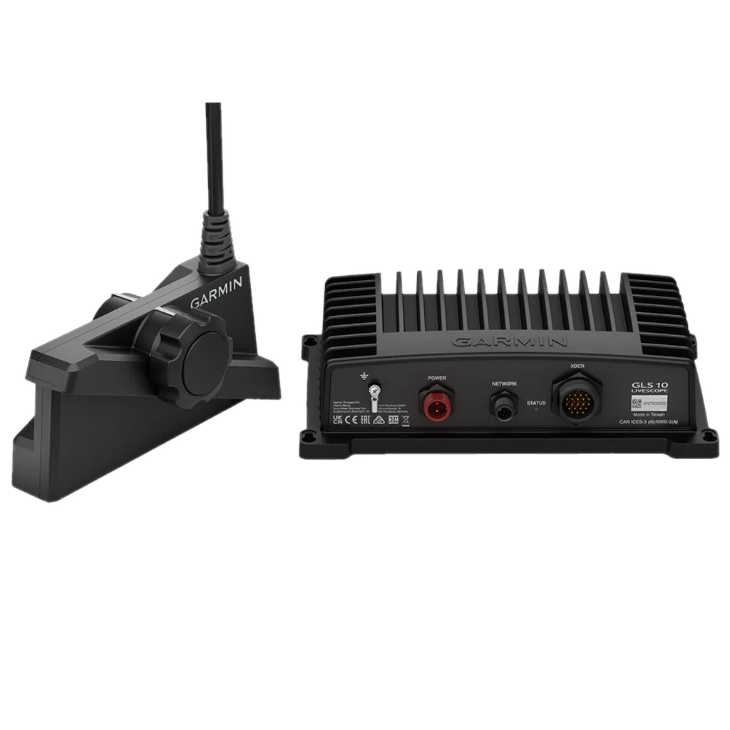
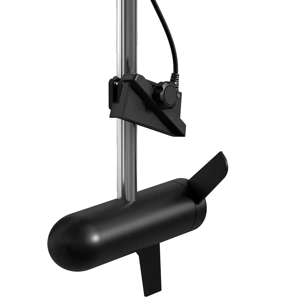
This chartplotter supports a variety of Garmin transducers (sold separately), including the Panoptix LiveScope™ scanning sonar system, which lets you see all around your boat in real time.
VIVID COLOR PALETTES
High-contrast vivid scanning sonar color palettes make it easier than ever to distinguish targets and structure.
OPTIONAL TRANSDUCER BUNDLE
Select the transducer bundle to add a GT56 transducer for Garmin CHIRP traditional sonar and Ultra High-Definition ClearVü and SideVü scanning sonars. With three scanning sonar frequencies and 20% greater range for our UHD SideVü sonar, you’ll get top performance at all depths.
PRELOADED MAPPING
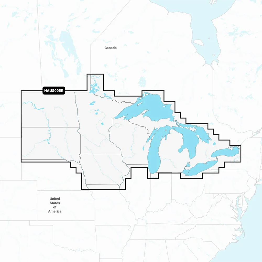
Experience unparalleled coverage and detail with preloaded LakeVü g3 inland maps featuring integrated Navionics® data. Maps cover more than 18,000 lakes with up to 1’ contours.
QUICKDRAW CONTOURS
Create personalized fishing maps on-screen with 1’ contours. Keep the data to yourself, or share it with the Quickdraw Community on the Garmin Connect™ app3.
NETWORK CAPABLE
If you have multiple compatible ECHOMAP UHD or ECHOMAP Ultra devices on your boat, the 7” and 9” models can share information — such as sonar, user data and charts — with them.
NMEA 2000® AND NMEA 0183 NETWORKS
Connect to your compatible autopilots, digital switching, weather, Fusion-Link™ audio system, media, VHF, AIS, engine data, heading sensors — such as the SteadyCast™ sensor — and more from one screen.
ACTIVECAPTAIN® APP
Built-in Wi-Fi® connectivity pairs with the free all-in-one mobile app for access to the OneChart™ feature, smart notifications, software updates, Garmin Quickdraw™ Community data and more1.
FORCE® TROLLING MOTOR COMPATIBILITY
Take control of the most powerful and efficient trolling motor available2, route it to waypoints, follow tracks and more from the screen of your chart plotter.
ENGINE CONNECTIVITY
Connect this chartplotter to different kinds of engines — including select Mercury and Yamaha® models — to see RPMs, fuel flow, temperature, trim and other important information at a glance. You may need additional hardware, so be sure to check with your engine manufacturer.
| General | |
|---|---|
| Dimensions: | 11.4" x 6.5" x 2.4" (28.2 x 16.4 x 6.0 cm) |
| Weight: | 2.3 lbs (1.0 kg) |
| Water Rating: | IPX7 |
| Touchscreen | |
| Display Type: | WVGA, NP |
| Display Size: | 7.8" x 4.8"; 9" diagonal (19.9 x 11.3 cm; 22.9 cm diagonal) |
| Display Resolution: | 800 x 480 pixels |
| Mounting Options: | Bail or flush |
| Input: | Touchscreen with Keyed Assist |
| Maps & Memory | |
| Accepts Data Cards: | 1 microSD card; 32 GB maximum size |
| Waypoints: | 5000 |
| Track Points: | 50,000 |
| Tracks: | 50 saved tracks |
| Navigation Routes: | 100 |
| Sensors | |
| GPS: | Has built-in receiver |
| Receiver: | 5 Hz |
| NMEA 2000 Compatible: | Yes |
| NMEA 0183 Compatible: | Yes |
| Supports WAAS: | Yes |
| Built-in Maps | |
| LakeVu (inland): | Yes |
| Tide Tables: | Yes |
| Optional Map Support | |
| BlueChart g3, BlueChart g3 Vision, LakeVü g3, LakeVü g3 Ultra, Garmin Navionics+™, Garmin Navionics Vision+™, TOPO 100K, Standard Mapping, Garmin Quickdraw Contours | |
| Chartplotter Features | |
| AIS / DSC: | Supported |
| Fusion-Link™ Compatible: | Yes |
| ActiveCaptain® Compatible: | Yes |
| Wireless Remote Compatible: | Yes |
| Sailing Features: | Yes |
| Electrical Features | |
| Power Input: | 9 to 18 Vdc |
| Typical Current Draw at 12 Vdc: | 1.0 A |
| Max Current Draw at 12 Vdc: | 1.5 A |
| Max Power Usage at 10 Vdc: | 18 W |
| Sonar Features | |
| Displays Sonar: | Yes |
| Power Output: | 500 W |
| Traditional Sonar: | Built-in (single channel CHIRP, 70/83/200 kHz, L/M/H CHIRP) |
| ClearVü: | Built-in 260/455/800/1000/1200 kHz |
| SideVü: | Built-in 260/455/800/1000/1200 kHz |
| Panoptix™ / LiveScope: | Supported |
| Connections | |
| NMEA 2000® Ports: | 1 |
| NMEA 0183 Input (Rx): | 1 |
| NMEA 0183 Output (Tx): | 1 |
| Garmin Marine Network Ports: | 1 Panoptix™ port |
| 12-Pin Transducer Ports: | 1 |
In the Box:
-No Transducer*
-ECHOMAP UHD 93sv with LakeVü g3 for U.S.
-8-pin transducer to 12-pin sounder adapter cable
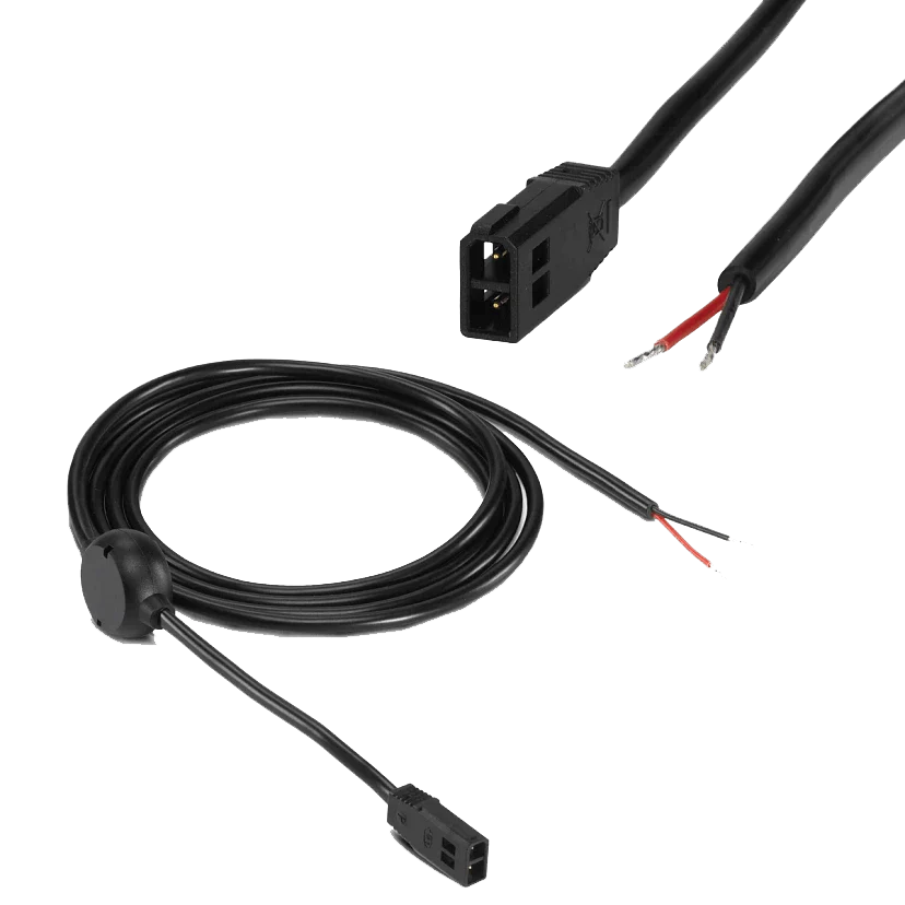
-Power/data cable
-Tilt mount with quick release cradle
-Flush mount
-Protective cover
-Hardware
-Documentation
Description
LESS TIME FINDING. MORE TIME FISHING.
The sunlight-readable 9” touchscreen chart plotter features a quick-release bail mount, and the transducer bundle adds Ultra High-Definition scanning sonar and CHIRP traditional sonar.
- See below and around your boat in incredible detail with the transducer bundle.
- Navigate any waters with preloaded LakeVü g3 inland maps.
- Share data and maps with select ECHOMAP devices on your network.
- Manage your marine experience from nearly anywhere1.
- Control the most powerful trolling motor available2.
- Create your own maps on the fly and tailor them to fit your needs.
SONAR SUPPORT
This chartplotter supports a variety of Garmin transducers (sold separately), including the Panoptix LiveScope™ scanning sonar system, which lets you see all around your boat in real time.
VIVID COLOR PALETTES
High-contrast vivid scanning sonar color palettes make it easier than ever to distinguish targets and structure.
OPTIONAL TRANSDUCER BUNDLE
Select the transducer bundle to add a GT56 transducer for Garmin CHIRP traditional sonar and Ultra High-Definition ClearVü and SideVü scanning sonars. With three scanning sonar frequencies and 20% greater range for our UHD SideVü sonar, you’ll get top performance at all depths.
PRELOADED MAPPING
Experience unparalleled coverage and detail with preloaded LakeVü g3 inland maps featuring integrated Navionics® data. Maps cover more than 18,000 lakes with up to 1’ contours.
QUICKDRAW CONTOURS
Create personalized fishing maps on-screen with 1’ contours. Keep the data to yourself, or share it with the Quickdraw Community on the Garmin Connect™ app3.
NETWORK CAPABLE
If you have multiple compatible ECHOMAP UHD or ECHOMAP Ultra devices on your boat, the 7” and 9” models can share information — such as sonar, user data and charts — with them.
NMEA 2000® AND NMEA 0183 NETWORKS
Connect to your compatible autopilots, digital switching, weather, Fusion-Link™ audio system, media, VHF, AIS, engine data, heading sensors — such as the SteadyCast™ sensor — and more from one screen.
ACTIVECAPTAIN® APP
Built-in Wi-Fi® connectivity pairs with the free all-in-one mobile app for access to the OneChart™ feature, smart notifications, software updates, Garmin Quickdraw™ Community data and more1.
FORCE® TROLLING MOTOR COMPATIBILITY
Take control of the most powerful and efficient trolling motor available2, route it to waypoints, follow tracks and more from the screen of your chart plotter.
ENGINE CONNECTIVITY
Connect this chartplotter to different kinds of engines — including select Mercury and Yamaha® models — to see RPMs, fuel flow, temperature, trim and other important information at a glance. You may need additional hardware, so be sure to check with your engine manufacturer.
| General | |
|---|---|
| Dimensions: | 11.4" x 6.5" x 2.4" (28.2 x 16.4 x 6.0 cm) |
| Weight: | 2.3 lbs (1.0 kg) |
| Water Rating: | IPX7 |
| Touchscreen | |
| Display Type: | WVGA, NP |
| Display Size: | 7.8" x 4.8"; 9" diagonal (19.9 x 11.3 cm; 22.9 cm diagonal) |
| Display Resolution: | 800 x 480 pixels |
| Mounting Options: | Bail or flush |
| Input: | Touchscreen with Keyed Assist |
| Maps & Memory | |
| Accepts Data Cards: | 1 microSD card; 32 GB maximum size |
| Waypoints: | 5000 |
| Track Points: | 50,000 |
| Tracks: | 50 saved tracks |
| Navigation Routes: | 100 |
| Sensors | |
| GPS: | Has built-in receiver |
| Receiver: | 5 Hz |
| NMEA 2000 Compatible: | Yes |
| NMEA 0183 Compatible: | Yes |
| Supports WAAS: | Yes |
| Built-in Maps | |
| LakeVu (inland): | Yes |
| Tide Tables: | Yes |
| Optional Map Support | |
| BlueChart g3, BlueChart g3 Vision, LakeVü g3, LakeVü g3 Ultra, Garmin Navionics+™, Garmin Navionics Vision+™, TOPO 100K, Standard Mapping, Garmin Quickdraw Contours | |
| Chartplotter Features | |
| AIS / DSC: | Supported |
| Fusion-Link™ Compatible: | Yes |
| ActiveCaptain® Compatible: | Yes |
| Wireless Remote Compatible: | Yes |
| Sailing Features: | Yes |
| Electrical Features | |
| Power Input: | 9 to 18 Vdc |
| Typical Current Draw at 12 Vdc: | 1.0 A |
| Max Current Draw at 12 Vdc: | 1.5 A |
| Max Power Usage at 10 Vdc: | 18 W |
| Sonar Features | |
| Displays Sonar: | Yes |
| Power Output: | 500 W |
| Traditional Sonar: | Built-in (single channel CHIRP, 70/83/200 kHz, L/M/H CHIRP) |
| ClearVü: | Built-in 260/455/800/1000/1200 kHz |
| SideVü: | Built-in 260/455/800/1000/1200 kHz |
| Panoptix™ / LiveScope: | Supported |
| Connections | |
| NMEA 2000® Ports: | 1 |
| NMEA 0183 Input (Rx): | 1 |
| NMEA 0183 Output (Tx): | 1 |
| Garmin Marine Network Ports: | 1 Panoptix™ port |
| 12-Pin Transducer Ports: | 1 |
In the Box:
-No Transducer*
-ECHOMAP UHD 93sv with LakeVü g3 for U.S.
-8-pin transducer to 12-pin sounder adapter cable
-Power/data cable
-Tilt mount with quick release cradle
-Flush mount
-Protective cover
-Hardware
-Documentation