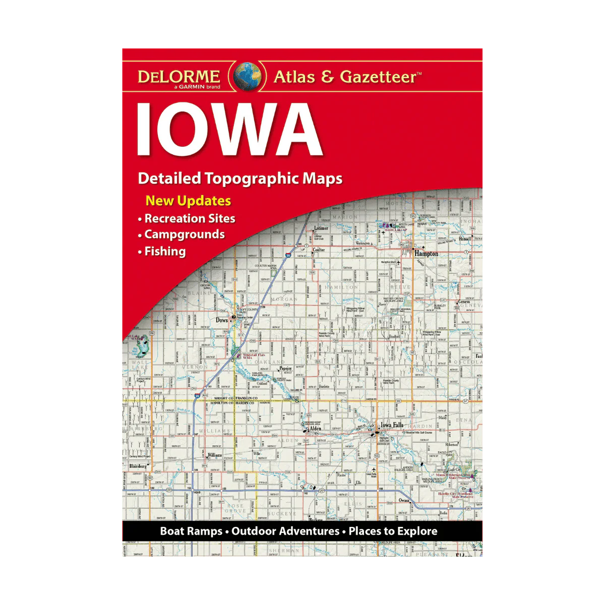
LAKEMAPS ATLAS & GAZETTEER - IOWA
Packed with rich detail, DeLorme’s Atlas & Gazetteer is an essential guide for anyone looking to explore the Iowa outdoors. Its full-color topographic maps—supported by an extensive index—highlight everything from towns and cities to historic landmarks, scenic routes, recreation areas, trailheads, boat launches, and top fishing locations.
With 51 detailed map pages in total, this Atlas & Gazetteer delivers one of the most complete and reliable references for navigating Iowa’s wild and rural landscapes.
Features:
-
Vibrant, full-color topo maps covering cities, towns, historic points, scenic drives, recreation spots, trailheads, boat ramps, and top fishing areas
-
Thorough, easy-to-use index
-
Latitude/longitude grid overlays on each map for seamless GPS navigation
-
Inset maps for major cities and all state-owned lands
Description
Packed with rich detail, DeLorme’s Atlas & Gazetteer is an essential guide for anyone looking to explore the Iowa outdoors. Its full-color topographic maps—supported by an extensive index—highlight everything from towns and cities to historic landmarks, scenic routes, recreation areas, trailheads, boat launches, and top fishing locations.
With 51 detailed map pages in total, this Atlas & Gazetteer delivers one of the most complete and reliable references for navigating Iowa’s wild and rural landscapes.
Features:
-
Vibrant, full-color topo maps covering cities, towns, historic points, scenic drives, recreation spots, trailheads, boat ramps, and top fishing areas
-
Thorough, easy-to-use index
-
Latitude/longitude grid overlays on each map for seamless GPS navigation
-
Inset maps for major cities and all state-owned lands